GIS in Water
Intelligent Water pipeline Management with GIS
Overview
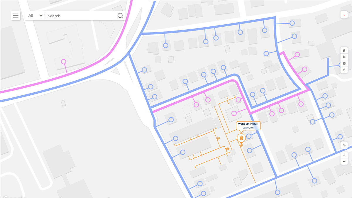
With integration of GIS, the organizing of data for the water distribution networks design, analysis and network management is simplified. GIS can contribute to decision making, damage control and planning for valve closing and opening, pipe break, service area managements. GIS empowers water networks with modern data model, out-of-the-box analytics tools, and easy-to-use maps, simplifying day-to-day operations.

Storage and management of geospatial data

Water Network management and Planning

Asset management

Operational Intelligence

Outage Management
How GIS in Water Pipeline
What Hexamap provides for GIS in water pipeline?
Benefits of GIS In water utilities
GIS is used for water pipeline distribution organization for there daily operations such as:
- Plan route to ensure maximum reach with minimum length
- Reduce the network design time
- Identification of weak pipeline section and leakage management
- Integrated system for managing the water assets.