GIS in Forestry
Overview
GIS for forestry provides crucial information about the natural resources and helps to plan & manage in sustaining these resources. GIS can perform Forest cover mapping, comparative analysis, Forest Fire modelling , Animal tracking , landscape and Habitat planning, Further, the results of these analysis can be visualized and reported to support in tactical decision making.
How the GIS is used?
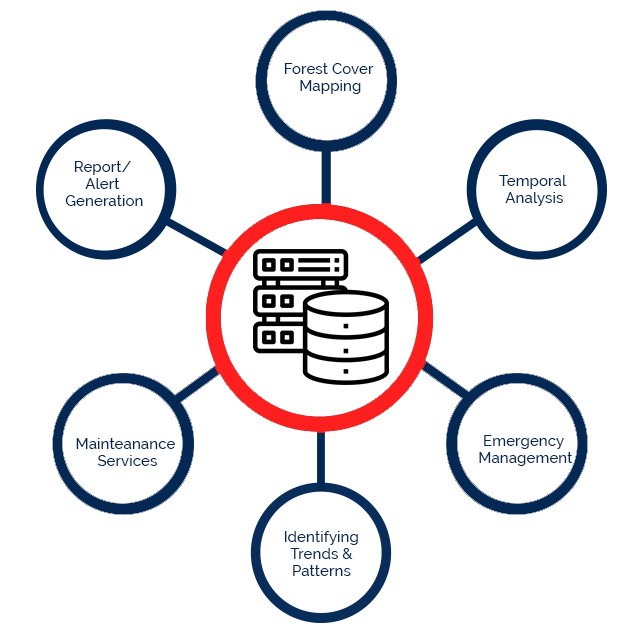
How GIS in Forestry
What Hexamap provides for GIS in Forestry?
Enterprise GIS Solution Deployment
Data Migration
Dashboards & Reporting
Mobile Application Development
Integration with ERP/SAP and other subsystem
Operation & Maintenance
Benefits of GIS in Forestry
Some of the major benefits of GIS in forestry, such as
- Planning for Afforestation strategies.
- Futuristic Resource planning.
- Monitoring and tracking the movements of animals.