Construction Progress
Enhancing Construction Productivity with Visual Intelligence
Overview
Geospatial Data Analysis enables to understand and monitor construction progress and to ensure that project strictly adheres to construction timelines & budgets. The construction industry would benefit from innovative solutions for operational efficiency, productivity improvement, and real-time progress monitoring based on actual site conditions by adopting to Geospatial management.

Drone based surveillance

Accident Analysis

Construction Progress

Work force Management

Operation & Maintenance
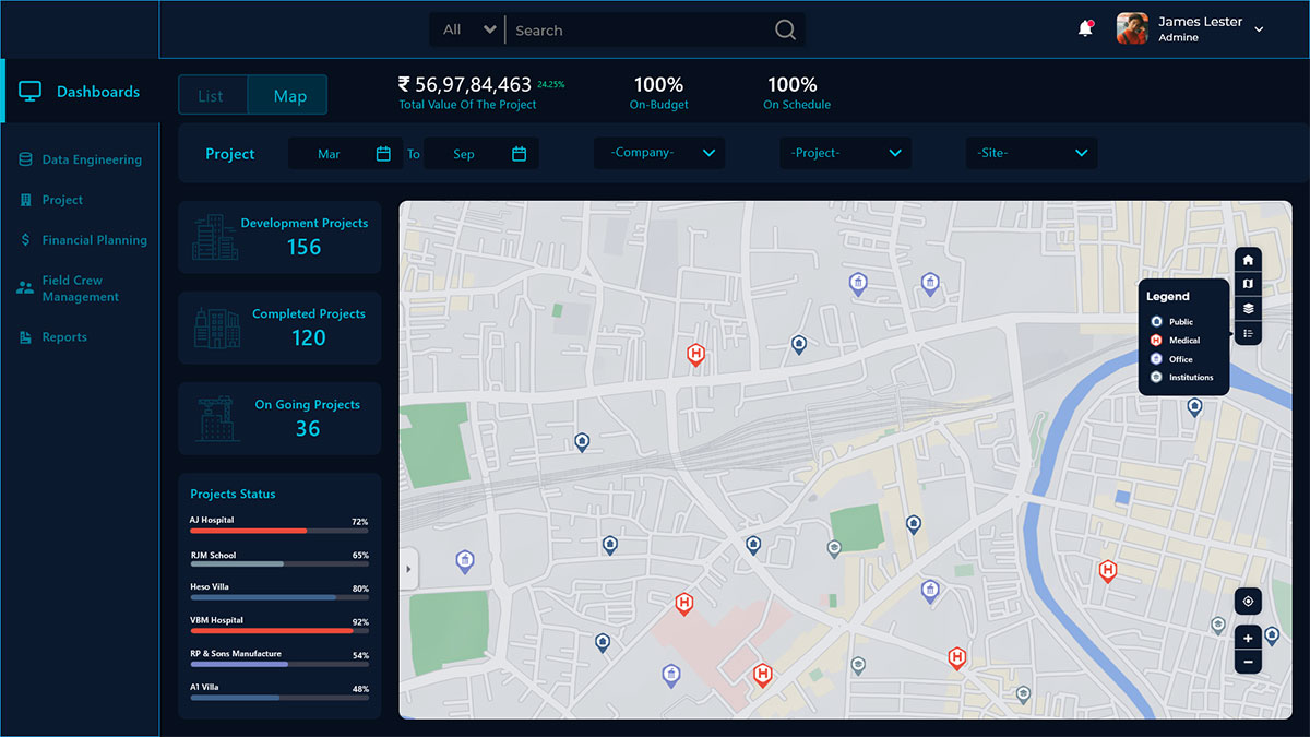
Construction – Enhancing Construction Productivity with Visual & Geospatial Intelligence Screen Is cropped
What Hexamap provides for Construction progress?

Enterprise GIS Solution Deployment

GIS Desktop Customization

Data Migration

Dashboards & Reporting

Mobile Application for Inspection

Integrations with other sub systems
Benefits of GIS In Construction progress
Benefits of GIS and Drone technologies in construction progress,
- Immediate detection of deviations and a considerable reduction in the cost of reworks.
- Saves project progress monitoring time.
- Reduces manpower requirements and project cost.
- Ensure sufficient stocks maintained for unhindered project progress.