GIS in Smart city
Smart City GIS is an integrated cross sectoral platform to collect, manage, compile, analyze and visualize spatio temporal information for sustainable urban planning, development and management.
Overview
A GIS centered information system providing an IT framework for Geospatial data and applications through every aspect of the city development life cycle. The customer centric GIS solutions are user-friendly, versatile, and can be integrated into any existing IT infrastructure with minimum cost and effort to the clients.

Planning and Design

GIS Data Analysis

Asset managemen

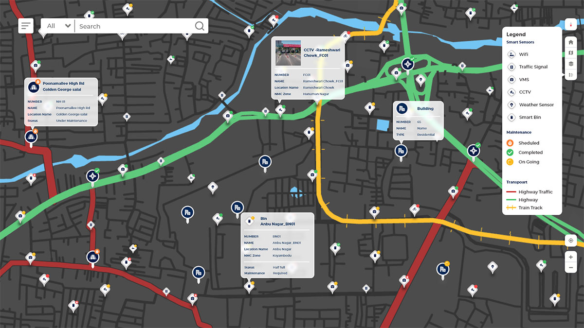
Real time Monitoring

Operation & Maintenance
GIS is central to Smart Cities?
What Hexamap offers in Smart city?

Geospatial Database Building

Enterprise GIS Deployment

Mobile Application

Data Migration

GIS Dashboard & Reporting

Integrations with ICCC and other subsystem
Benefits of GIS in smart cities
- Improved Decision making
- Simplified Future smart components planning.
- Supports Field mobility and enhances O&M efficiency.
- Decision support system for Urban planning and Infrastructure development.
- Eases City surveillance and streamlines Crime Analysis.