GIS in mining
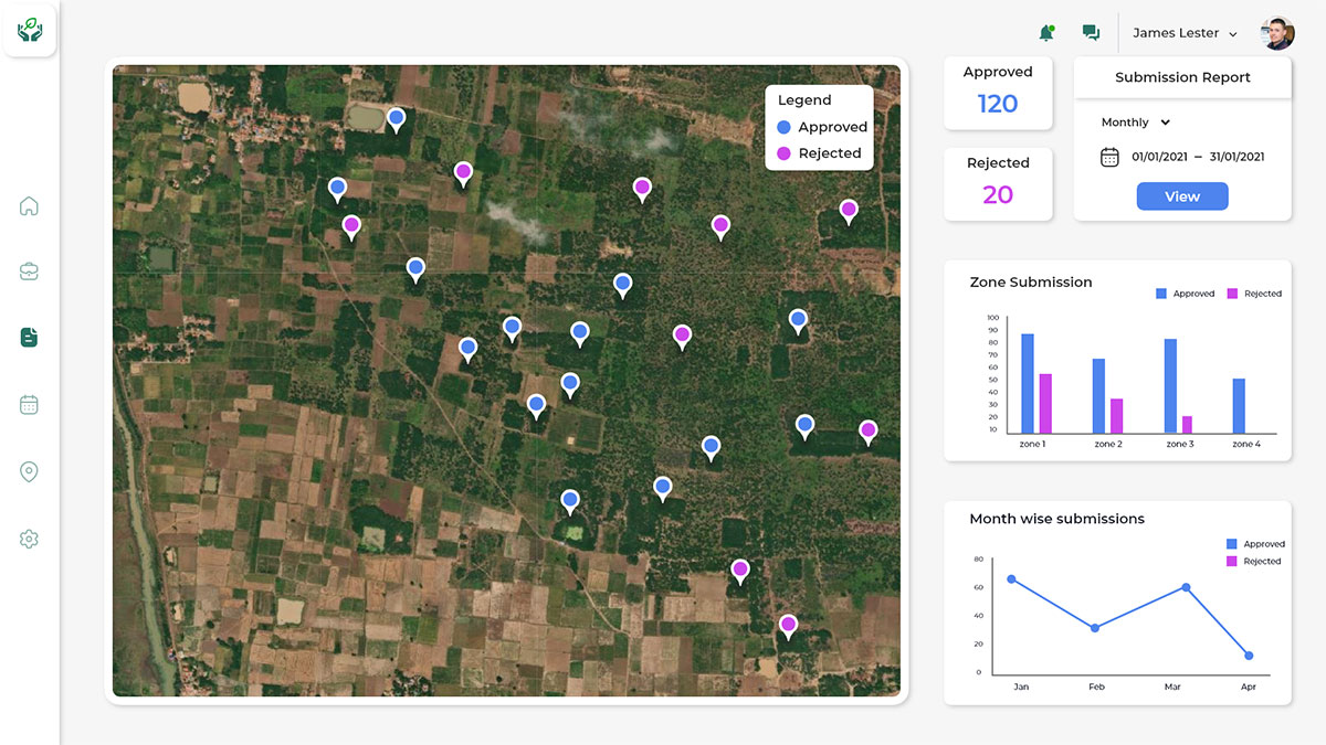
GIS plays very important role in mining minerals, prominently used for monitoring safety of mines. User can monitor the safe production of a coal mine and make decisions based on it in real time. GIS helps the Mining and Minerals Department for managing and digitalizing the Land records, Encroachment Analysis and Geospatial analysis using satellite images.

Land records Digitalization

Change Detection

Reports & Alerts

Operational Management

Terrain Analysis
How GIS is Mining
What Hexamap provides for GIS in Mining?

Enterprise GIS Solution Deployment

Data Migration

Dashboards & Reporting

Mobile Application Development

Integration with ERP/SAP and other subsystem

Operation & maintenance
Benefits of GIS in Mining
Some of the major benefits of GIS in mining, such as
- Provides integrated platform managing the land records
- Enables the user to perform terrain analysis